Rapid detection
and classification
of maritime vessels
using satellite
SAR imagery
What is SAR?
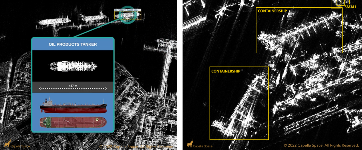
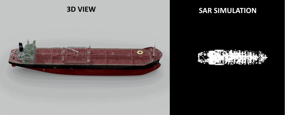
SAR (Synthetic Aperture Radar) is a powerful remote sensing technology bouncing microwave signals off the Earth’s surface to detect physical properties.
It is used to create a high-resolution two-dimensional representation of the imaging area.
Imagery can be captured day and night, without the usual visibility limitations of optical data and is well suited to monitoring extensive areas.
Benefits of SAR
All Weather
Day and night
High spatial resolution
High temporal resolution
Global reach