ENERGY

Detection & Classification of VESSELS TRANSPORTING ENERGY PRODUCTS

Thousands of tankers and carriers transport energy products such as crude oil, LNG (liquified natural gas) and petroleum products all around the world.  These vessels can be highly dangerous due to their content and financially very valuable. 

Our solution provides accurate detection and classification of a vast catalogue of civil vessels in any weather conditions, day or night using SAR (Synthetic Aperture Radar) imagery and AI-based software.

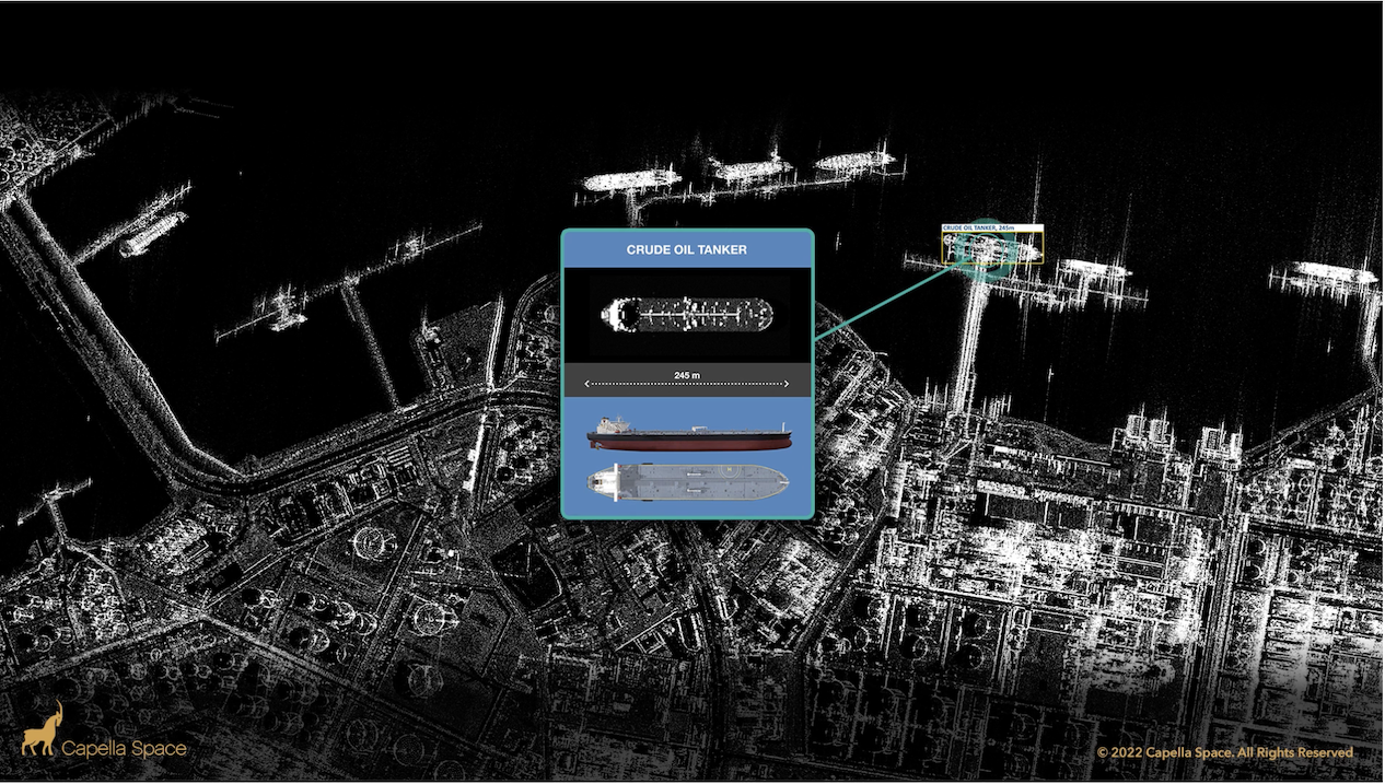
Energy transportation - Oil tanker detection and classification

Above – Detection and classification of a crude oil tanker using our SAR simulator to train AI-based software to 90% accuracy.

HOW WE DO IT

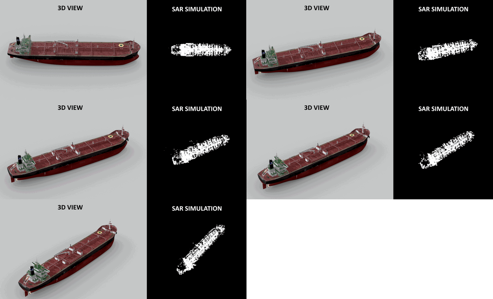
SATIM has built a highly accurate simulator for generating synthetic SAR signatures. The simulator allows us to simulate a SAR signature of any object and any SAR system.

Thanks to the simulator, we can add new types of vessels (e.g, a new type, class group or an unusual type) to train our AI model and to be classified within days.

SAR simulation software from 3D models - Satim

OUR RESULTS

Our AI-based software solution is capable of providing over 90% accurate vessel classification of a large catalogue of energy transportation vessels in port and on the open ocean. We have the capabilities to add new vessel types within days.

Rapid detection
and classification
of maritime vessels
using satellite
SAR imagery

What is SAR?

SAR (Synthetic Aperture Radar) is a powerful remote sensing technology bouncing microwave signals off the Earth’s surface to detect physical properties.

It is used to create a high-resolution two-dimensional representation of the imaging area.

Imagery can be captured day and night, without the usual visibility limitations of optical data and is well suited to monitoring extensive areas.

Benefits of SAR

  • ALL WEATHER
  • DAY AND NIGHT
  • HIGH SPATIAL RESOLUTION
  • HIGH TEMPORAL RESOLUTION
  • GLOBAL REACH


What is SAR?

SAR (Synthetic Aperture Radar) is a powerful remote sensing technology bouncing microwave signals off the Earth’s surface to detect physical properties.

It is used to create high-resolution two-dimensional representations of objects.

Imagery can be captured day and night, without the usual visibility limitations of optical data and is well suited to monitoring extensive areas.

Rapid detection
and classification
of maritime vessels
using satellite
SAR imagery

   Benefits of SAR?

  • ALL WEATHER

  • DAY & NIGHT

  • HIGH SPATIAL RESOLUTION

  • HIGH TEMPORAL RESOLUTION

  • GLOBAL REACH